Carson Property

  • Overview

    The Carson property abuts the town-owned Brockway Preserve and is managed as part of that parcel.

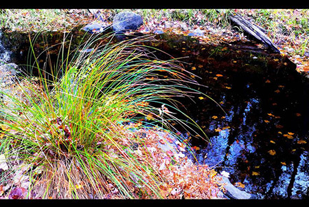
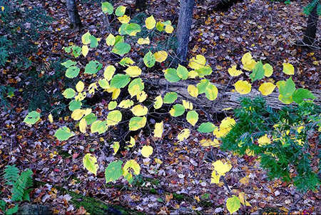
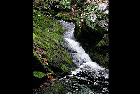
    This parcel of about 30 acres was purchased with money from the Open Space bond in 2004. The town has conveyed a conservation easement on the property to Five Rivers Conservation Trust. The parcel’s many streams and wet areas are not conducive to development of a trail system, but do help to protect downstream water quality.

Continue Reading

John Brockway Nature Preserve

  • Overview

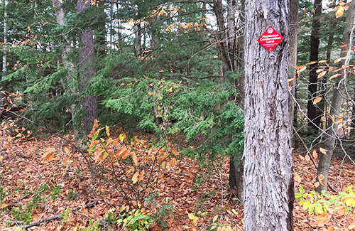
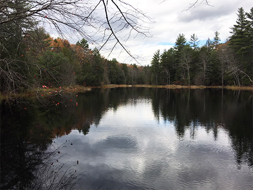
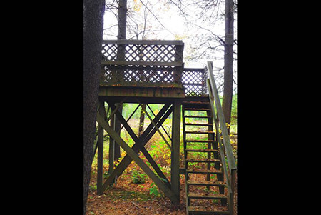
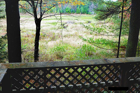
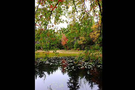
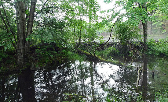
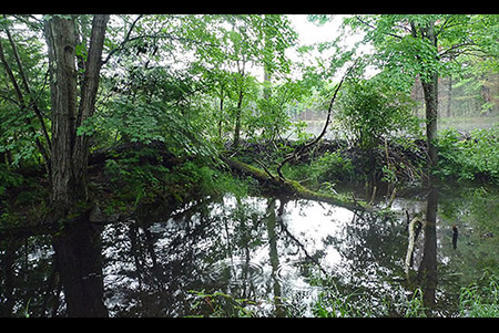
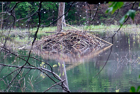
    The trail on the marshy John Brockway Nature Preserve is short but compensates with handsome views across the old mill pond and lots of birdlife. The property is jointly managed by New Hampshire Audubon and the Hopkinton Conservation Commission.

    Directions:
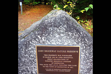
    From Jewett Road, turn onto Farrington Corner Road (by Family Tree Health Care). After 1.5 miles, look for small parking area on your left where there is a Brockway dedication plaque on a granite boulder.

    Walking times:
    McArnerny Marsh Loop (yellow blazes): 10 minutes.
    Verville-Benson Pond Loop (red blazes): 15 minutes

  • Description

    The trail on this marshy parcel is short but compensates with handsome views across the old mill pond and lots of birdlife. The property is jointly managed by New Hampshire Audubon and the Hopkinton Conservation Commission.

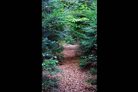
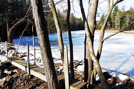
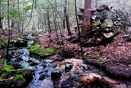
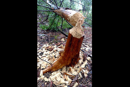
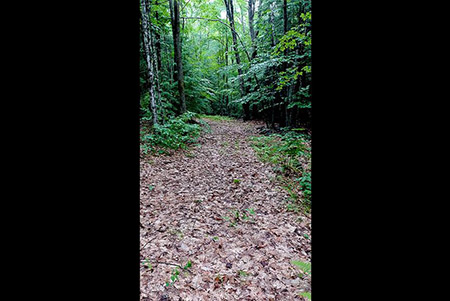
    This 98-acre town-owned lot is located on the northeast side of Farrington Corner Road, across from the Brockway Road intersection. Although the trail is not long, it compensates with handsome views across the old mill pond and swamps along Boutwell Mill Brook, and the lot contains numerous vernal pools and seeps. A unique feature of the lot is that it was used as water storage system for two water-powered mills. The trail starts by crossing the old fieldstone dam, and one mill foundation is still visible on the southwest side of Farrington Corner Road. Once across the old dam, the trail incorporates old woods roads and has side loops to the various wetland areas.

    History

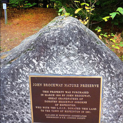
    The preserve was acquired by the town in 1993, funded in part by Dorothy Brockway Osborne in memory of her great grandfather, John G. Brockway, whose farm was located nearby. Although Dorothy Osborne was born in New York City and spent most of her life there (for many years as headmistress of the prestigious Spence School), she never forgot her family roots in Hopkinton. When she helped the town acquire the preserve, she gave an endowment to New Hampshire Audubon to run educational programs on the property. The property is jointly managed by New Hampshire Audubon and the Hopkinton Conservation Commission. Dorothy Osborne passed on in 2001 at the age of 103.

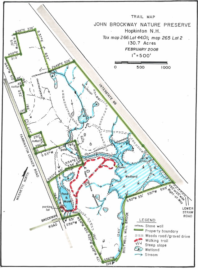
  • The John Brockway Nature Preserve trail map is shown below. Please click the text or image link to open/download/print the PDF map.

    Brockway Nature Preserve Trails – Click here to open/download/print PDF map.

    brockway-map

  • 1
    2
    3
    4
    5
    6
    7
    8
    9
    10

Continue Reading

Bohanan Farm

  • This large, privately owned, working dairy farm has a conservation easement protecting its agricultural fields, working forests, and four miles of frontage on the Contoocook, Blackwater and Warner Rivers. The farmers welcome public use of their network of trails, farm roads and river frontage.

    There are four walking routes: The Blackwater Loop with views of the Blackwater River; the Contoocook River Overlook Trail (accessed from the Blackwater Loop); the Corser Hill Loop to the hilltop cellar hole of the old Corser farmstead; and Amesbury Field Road to the Amesbury farm field at the confluence of the Warner and Contoocook Rivers. These walking routes are also popular in winter for cross-country skiing and snowshoeing.

    Directions:
    From Contoocook or Hopkinton Villages, take Penacook Road towards the Transfer Station. Parking for all trails is at the Bohanan Farm trailhead kiosk on the left after crossing the Contoocook River at Tyler Bridge (945 Penacook Road).

    Walking Times (from parking area):
    Blackwater Loop (blue blazes): 1.5 miles round trip; 45 minutes.
    Contoocook Overlook Trail (yellow blazes): 2.2 miles round trip; 1 to 1-1/4 hour
    Corser Hill Loop: (orange blazes): 2.3 miles round trip; 1 hour
    Amesbury Field Road: 3.2 miles round trip; 1.5 hour

  • Description

    Four Walking Loops

    Blackwater River Loop: This walk begins at the edge of the cornfield on Burrage Road, the road directly across from the entrance to Bohanan Farm. After a short walk along the Contoocook River, look for the sign that marks the beginning of the Blackwater River Loop. The path starts in the woods next to the cornfield and enters a flat wooded area of well-managed pine and mixed hardwood. A network of woods roads and foot paths leads past vernal pools before reaching the edge of the old river bed, now floodplain along the Blackwater River. A side loop called the Contoocook Overlook Trail leads to Horne Town Forest and a spectacular lookout at the confluence of the Blackwater and Contoocook Rivers. Other lookout points along the Loop offer river views. The relatively level terrain and wide pathways make this ideal for cross country skiing as well as walking.

    Contoocook Overlook Loop: This loop trail was added in the fall of 2016 to provide access to Horne Town Forest, a 14-acre parcel acquired in 2015. The new town forest is surrounded by Bohanan Farm at the confluence of the Blackwater and Contoocook Rivers. The trail to the overlook leaves the Blackwater River Loop at the half way point, adding ¾ of a mile to the Blackwater Loop (2.2 miles total with the overlook trail). The trail follows a bluff above the Blackwater River before turning toward the Contoocook River where an overlook provides beautiful views where the two rivers converge. The trail climbs a short hill to a bluff along the Contoocook River, follows through mature woodlands with views over Bohanan fields, and rejoins the Blackwater River Loop.

    Corser Hill Loop: This walk begins by turning left from the parking area at Bohanan Farm and following the gravel farm road as it passes through farm fields. Access to Corser Hill is on the right side of the road shortly after turning onto the farm road. This path follows along the edge of a field before reaching the woods road that leads to Corser Hill. (Note that this access way may change from time to time depending on agricultural activities.) The loop enters the Corser pasture through a stile at the stone fence, and climbs through the open pasture to the top of the hill where a grove of large maple trees marks the site of Ham Corser’s cellar hole. Large boulders in the field have markings where Native Americans ground their corn. Be aware of the cows grazing in the pasture in season. The path continues north through the pasture to a stile at the far end, then follows a woods road back to the juncture south of the pasture. Retrace the path and farm road back to the parking area.

    Amesbury Field Road: This walk begins by turning left from the parking area at Bohanan Farm and following the gravel farm road as it passes through farm fields. After passing through the Bohanan fields, the road crosses onto the Dustin property which was protected by a conservation easement in 2014. The roadway connects back to Bohanan Farm land and the Amesbury Field at approximately 1.6 miles. The farm road traverses several interesting water features including a small oxbow pond to the north (once the river channel) and an area along the Contoocook River that still floods during high water, helping to prevent downstream flooding during heavy rains. The silver maple floodplain forest provides an unusual and dynamic environment, which makes the area an important habitat for wildlife.

    History

    This farm has been under the careful management of the Bohanan family since 1907 and is now being run by a member of the fifth generation of the family. The farming history of the land goes back to the 1760s, when Enoch Eastman won two acres of the land in a game of horseshoes and gave it to his son Simeon who started farming there. There is an historic marker on the farm showing the site of the second ferry across the Contoocook River, built in 1772.

    In 2009, the town worked with Five Rivers Conservation Trust (www.5rct.org) to purchase a conservation easement on 413 acres, excluding an area around the house and barns. The property includes four miles of frontage on three different rivers, the Contoocook, Blackwater and Warner Rivers. In 2014, the town again worked with Five Rivers Conservation Trust to acquire a conservation easement on the 36-acre Dustin property, thereby linking the two Bohanan parcels and providing public access to Amesbury Field.

    These conservation easements allow the family, and any future owners, to continue sustainable agriculture and forestry, but prevents any further development. Please treat the land with consideration and be aware that sections may be closed to public access from time to time to accommodate agricultural and timber harvest activities.

    Hunting is permitted in season with appropriate license.

  • The four Bohanan Farm trails – The Blackwater Loop/Contoocook Overlook Trail and the Corser Loop/Amesbury Field Road — are shown below. Please click the text or image link to open/download/print the PDF map for the loop you want.

    Blackwater Loop/Contoocook Overlook Trail – Click here to open/download/print PDF map.

    bohanan-blackwater

    Corser Loop and Amesbury Field Road – Click here to open/download/print PDF map.

    bohanan-courser
  • River Access

    August 2013

    The Hopkinton Conservation Commission is pleased to announce the installation of a canoe/kayak access ramp at the Bohanan Farm conservation property.

    The gangway style ramp allows easy access to the river from the steep bank at the farm for canoes and kayaks. A drop-off area is located near the ramp and parking is provided at the informational kiosk off Penacook Road.

    The ramp project is a continuation of the commission’s efforts to provide public recreational opportunities at the farm property.

  • 1
    2
    3
    4
    5
    6
    7
    8
    10
    11
    12

Continue Reading

Bermuda Harris

  • Overview

    The Bermuda Harris property is 40 acres in Hopkinton and 70 acres in Warner. Road access is on the north side of Bound Tree Road, west of Pleasant Lake Road. There is an old woods road that leads into the property, but nearby parking is extremely limited.

    The town purchased the 40 acres of the Hopkinton land making up the Bermuda Harris tract in 2005 with money from the Open Space bond. The owner donated to Hopkinton another 70 adjacent acres located across the town line in Warner. The town has conveyed a conservation easement on the property to Five Rivers Conservation Trust.

    The parcel is managed as a town forest, without designated parking and trails.

  • 1
    2
    3
    4
    5
    6
    7

Continue Reading

Copyright 2023© Hopkinton NH Conservation Commission and Open Space Committee