Putney Hill Trails
-
From Putney Hill Road, near the intersection with Old Putney Hill Road, there are several trails that provide links to other trails and/or low-traffic roads with good walking terrain. Putney Hill, located at the geographic center of Hopkinton, was originally planned as the town center. Although the town center was later moved to what is now Hopkinton Village, a number of historic sites remain on Putney Hill. Historic plaques mark the location of the Putney Hill Garrison and cellar holes of the first parsonage and the home of Hopkinton’s first doctor. The historic Putney Hill Cemetery is a short walk from the intersection of Putney Hill and Old Putney Hill Roads.
Directions:
There is limited parking for several cars at the end of Putney Hill Road near the intersection with Route 103 and Gould Hill Road. The trails are a short walk from there. A possible future plan is to have a trailhead parking lot on Old Putney Hill Road that will be convenient to these trails. Stay tuned!Walking times:
Putney Hill – Greenway Connector: approximately .5 miles and about 10 minutes
First Parsonage Trail: approximately .5 miles to Dolly Road and about 10 minutes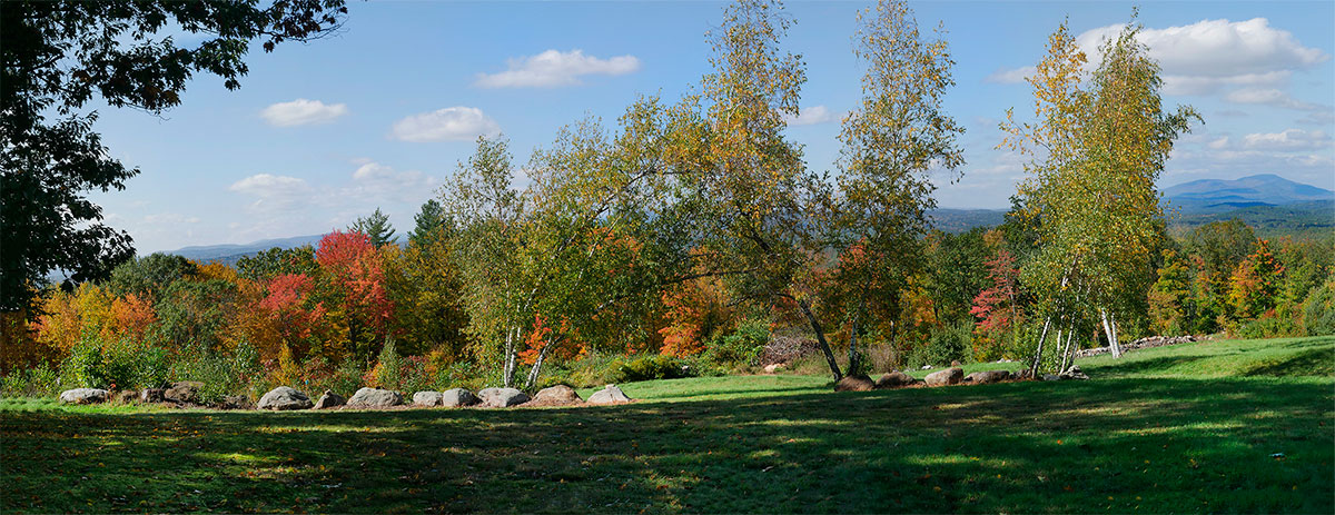
-
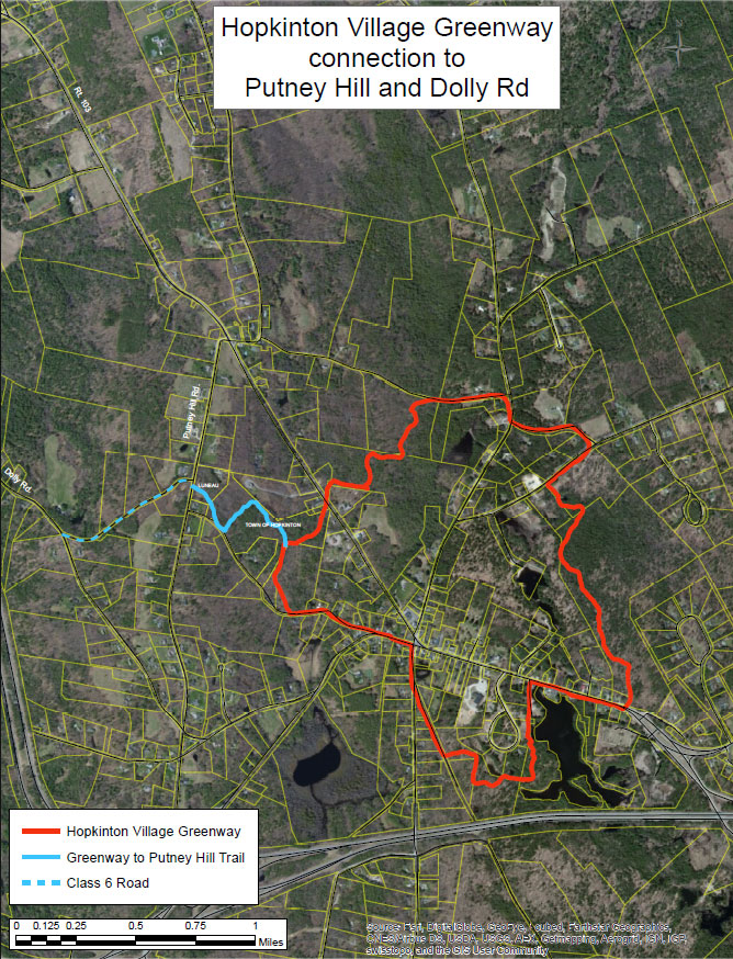
Putney Hill – Hopkinton Village Greenway Connector
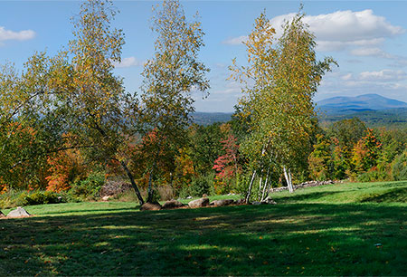
This trail connects Putney Hill Road, just north of its intersection with Old Putney Hill Road, to the Hopkinton Village Greenway, approximately .4 miles south from Hopkinton Road/Route 103. Marked with blue blazes, the trail crosses an open field on privately owned land and along stone walls to Town-owned property known as the “Aqueduct Lot”, previously a well-field for the Hopkinton Village Precinct. Along this section of the trail, recent logging opened a view to the northeast. The trail continues downhill to where it connects with the Hopkinton Village Greenway.
First Parsonage Trail
This is an old town road, now Class VI, which begins on the west side of Putney Hill Road near the historic marker and cellar hole designating the site of Hopkinton’s First Parsonage, located approximately .4 miles south of Hopkinton Road/Route 103. It is a short and pleasant downhill walk to Dolly Road. Many folks use this trail as a loop walk or fitness run which includes other routes on town roads or the trail network on Putney Hill Road which heads east to the Hopkinton Village Greenway or west to Cross Road toward Contoocook Village.
-
The Greenway Connection to Putney Hill and Dolly Road trail map and the Putney – Cross trail map are shown below. Please click the text or image links to open/download/print the PDF maps.
Greenway Connection to Putney Hill and Dolly Road – Click here to open/download/print PDF map.
-