Smith Pond Bog

  • Overview

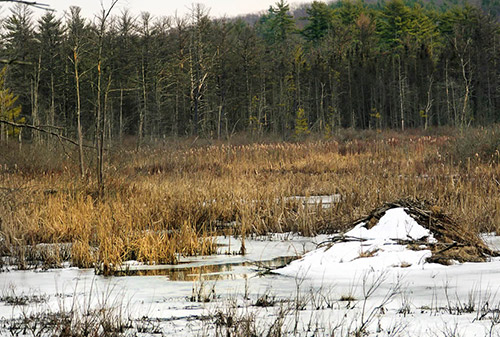
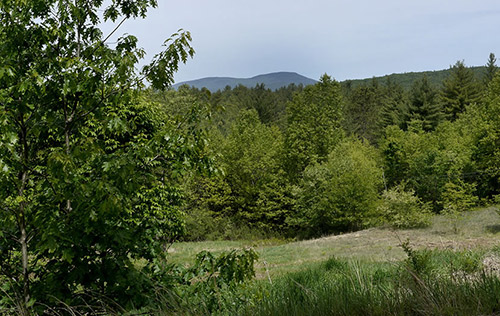
    The 59-acre Smith Pond Bog Wildlife Sanctuary, owned and managed by New Hampshire Audubon, is made up of a diverse mosaic of wetland habitats surrounding Smith Pond.

    This kettle hole pond, named for James Smith who settled nearby in 1765, covers almost eight acres. A kettle hole pond is created when a block of ice, buried in soil left behind by a retreating glacier, eventually melts and creates a deep, steep-sided pond.

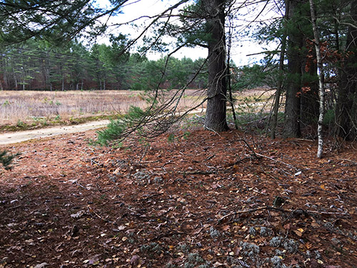
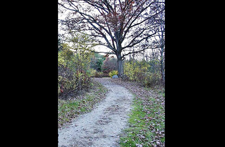
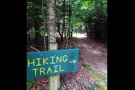
    Smith Pond Bog is open throughout the year during daylight hours. Although the trails are not currently maintained because of beaver activity, walkers can view the pond from the adjacent Beyer Property where an old logging road leads to a view the bog. The sanctuary’s primary purpose is to protect vital habitat for wildlife and plant life.

    Directions: From Hopkinton Village, proceed 1/4 mile west on Route 9/202, across from Gage Hill Road.

Continue Reading

Rollins Property

  • Overview

    The Rollins property, 48 acres on the north side of Penacook Road, just west of the junction with Gould Hill Road, has partly open fields that provide a view toward Mount Kearsarge. The view was one of the reasons the town voted to purchase the property in 2004 with money from the Open Space bond.

    The property also has frontage on Little Tooky Road, where a trailhead and small parking area (.2 miles down Little Tooky Road) provides access to the one-mile Little Tooky Trail, and includes a section on the historic Concord-Clarement Railroad line.

    The town has conveyed a conservation easement on the property to Five Rivers Conservation Trust.

Continue Reading

Mast Yard Forest

  • Overview

    Mast Yard State Forest lies in the northwest corner of Concord and northeast corner of Hopkinton, and provides 5 miles of interconnected trails that wind through shady forest and provide scenic views of Dolf Brook and the Contoocook River. The trails are open to hiking, mountain biking and cross-country skiing. Some trail sections follow former railroad grade, making them fairly flat, while others traverse slightly hillier terrain.

    Distance: About 5 miles total; hiking travel time: about two hours

    Directions: Take Broad Cove Road from Briar Hill Road. After passing under the powerlines, there is an opening on the left and a small area to park your car. Step over the large log to begin your walk.

  • The Trails

    The Mast Yard trail is a loop starting at the northwest corner of the parking lot off Broad Cove Road in Concord, just over the Hopkinton line. Taking the left fork after crossing Dolf Brook, turn right onto the old railroad bed, right again at the power lines and return over Dolf Brook. This loop, a total of about five miles, is relatively flat and excellent for hiking, mountain biking, and cross-country skiing with children. The trail along the railroad bed is linked via a pedestrian/snowmobile bridge over the Contoocook River to the Lehtinen Park Trails and Jim Hill River Walk in Concord.

    History

    According to Bouton’s History of Concord, in the early 1800’s this area was famous for supplying trees, two to three feet in diameter, that were used as masts for “His Majesty’s Royal Ships” and later as masts for various other vessels built on the seacoast. The best masts were from the northwesterly side of Horse Hill. The trees were “drawn” to the Contoocook River to an area now called the “Mast Yard,” then floated down to the Merrimack River. Larger logs were drawn by 52 teams of oxen (104 animals) along Borough Road to the sandbanks below Sewalls Falls and there “thrown” into the Merrimack River and floated to the coast.

    p>
  • The Mast Yard Forest trail map is shown below. Please click the text or image link to open/download/print the PDF map located on the City of Concord website.

    Mast Yard Forest Trails – Click here to open/download/print PDF map (City of Concord website).

Continue Reading

Houston Fields

  • Overview

    Houston Fields, located off of Pine St. behind Hopkinton’s Town Library and Senior Center, is the gemstone of the town’s recreation facilities. It is designed to serve all age groups from the very young to the elderly and it is the home for most town-sponsored team recreation activities.

    At present it is comprised of two full-sized soccer fields, two multi-purpose fields used for lacrosse, soccer and football, an official little league field and a children’s playground. Picnic areas, one with views of the entire park, have been developed near the playground.

    Wheelchair accessible paths and nature viewing locations are also available. The trails on Houston Park connect with the town-owned Stevens Rail Trail to the north.

  • 1
    2

Continue Reading

Hawthorne Town Forest

  • Overview

    This 111-acre forest is located close to the center of Hopkinton Village, yet the well used hiking trail has a wild and remote feeling as it passes through thick hemlock groves and a steep gorge. The Hawthorne Forest trails connect to the Hopkinton Village Greenway.

    Directions:
    From Hopkinton Village, proceed north on Briar Hill Road for 0.3 miles, then right on Rollins Road for 0.3 miles. The parking pullout is located on the right.

    Walking times:
    Full 1.7 mile loop: 40 minutes. Shortened loop via cut-off trail: 25 minutes.

  • This 111-acre town-owned lot is located just east of Hopkinton Village between Rollins Road and the east end of Main Street.

    Despite its location close to the town center, the thick hemlock groves and steep gorge along Rachael’s Brook give parts of the forest a wild and remote feel. By contrast, farther along the trail the slopes become gentler and land is more open with oak and maple trees and numerous stone walls. The walls mark the old fields and pastures of hard-working farmers who cleared and worked this land. A descendent of those farmers, Rachael Hawthorne Johnson, deeded 93 acres of this land to the town in 1989 with the help of LCIP State conservation funding. The other 18 acres along Rollins Road have belonged to the town since 1933 and were used as a stump dump and by the Highway Department. The former stump dump is now a sledding hill.

    The 1.7 mile trail begins by a kiosk in the parking area off Rollins Road and is marked by yellow blazes. About 100 yards after entering the forest, the trail crosses a bridge over Rachael’s Brook. Soon after the crossing, a trail junction marks the beginning of the loop trail. To the right are steep slopes and hemlock groves. To the left the trail rises more gradually.

    There is a cut-off situated halfway through the loop. The cut-off is about 200 yards long and reconnects to the loop trail.

    There is also a trail spur to Main Street which comes out just before Hawthorne Hill Road. It’s a short walk down Main Street to connect with the trails at Kimball Lake. These trails are part of the Greenway loop trail around Hopkinton Village. From the trailhead parking on Rollins Road, the Greenway trail heads east, parallel to Rollins Road, before crossing Rollins Road and following an unmaintained town road to Briar Hill Road.

  • The Hawthorne Town Forest trail map is shown below. Please click the text or image link to open/download/print the PDF map.

    Hawthorne Town Forest Trails – Click here to open/download/print PDF map.

    hawthorne-map

  • 1
    2
    3
    4
    5
    6

Continue Reading

Copyright 2026© Hopkinton NH Conservation Commission and Open Space Committee