Ransmeier Woods
-
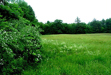
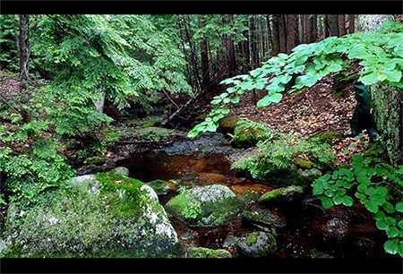
The 68-acre Ransmeier Woods property has two trails, offering both a field and woodland hiking experience within just a short drive of Hopkinton Village. The shorter trail circles a large hayfield and passes Smith Brook near an old dam. The longer trail continues through a mature woodland with views of the brook at the base of a steep ravine. The Ransmeier Woods trails connect to the Hopkinton Village Greenway from the longer loop trail.
Directions:
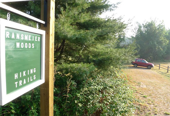
Parking for Ransmeier Woods is located next to the Police Station, 1696 Hopkinton Road between Hopkinton and Contoocook. The parking lot for the Ransmeier property is not plowed in the winter.Walking Time:
Orange Loop: 25 minutes; Blue loop via Orange Loop: 45 minutes -
The 68–acre Ransmeier Woods property has two trails, offering both a field and woodland hiking experience within just a short drive of Hopkinton Village. The shorter trail circles a large hayfield and passes Smith Brook near an old dam. The longer trail continues through a mature woodland with views of the brook at the base of a steep ravine. This trail connects to the Hopkinton Village Greenway trail.
Both trails start at the Police Station, skirting the right hand edge of the hayfield, then entering the woods and following Smith Brook along the edge of the woods close to the field. The trail passes near a now-broken dam/road across the brook that once provided access for farm vehicles. Shortly before a footbridge, the orange trail turns uphill to the left and returns to the field, circling the edge of the field back to the parking area. The Blue trail continues across the footbridge, with nice views of the brook, especially at times of high water, passing through mixed woodlands with some steeper pitches, crossing through some old stone walls and returning back to the bridge.
To connect to the Hopkinton Village Greenway from the trailhead parking area, follow the orange trail to the blue trail, cross over the footbridge and continue on the blue trail to its junction with the Greenway. Heading southwesterly (counter clockwise on the Greeway), follow the blue and yellow markers to the bridge marked “Derek’s Brook”. From there the trail crosses the brook, follows along a stone wall and crosses several boardwalks before crossing Route 103, about 500 feet north of the trailhead parking area. Heading northeasterly (clockwise) from where the blue trail intersects the Greenway, follow the Greenway to Old Stagecoach Road.
History
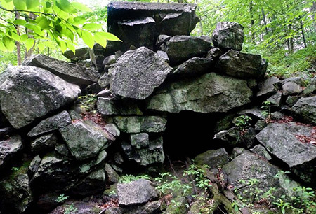
The area around Ransmeier Woods was settled before the town was incorporated in 1765. Numerous stone walls throughout the property are reminders of those early days. The original owner of the land lived across Smith Brook on nearby Briar Hill Road, where the house and barn still stand. A dam across Smith Brook created a farm pond which may have provided water storage for a sawmill downstream on Dolf Brook. After the Civil War much of the land here and throughout New Hampshire was allowed to grow back into woods.
The town purchased this land in 2006 from Joseph and Margaret Ransmeier with money voted from the town’s Open Space Bond, augmented by a grant from the State’s water supply protection program, awarded because the property is upstream from the Hopkinton Village Precinct’s water supply.
The land is further protected by a conservation easement held by Five Rivers Conservation Trust (www.5rct.org). The trail system was built by a group of Concord High School students under supervision of the Hopkinton Conservation Commission.
-
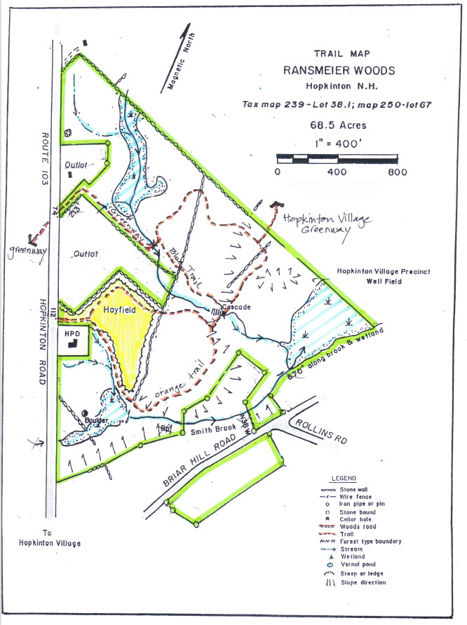
The Ransmeier Woods trail map is shown below. Please click the text or image link to open/download/print the PDF map.
Ransmeier Woods Trails – Click here to open/download/print PDF map.
-