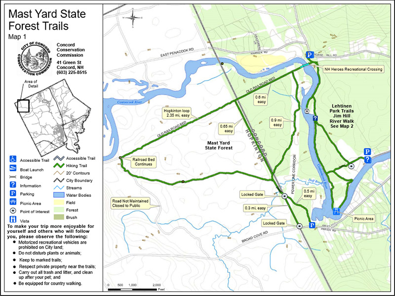
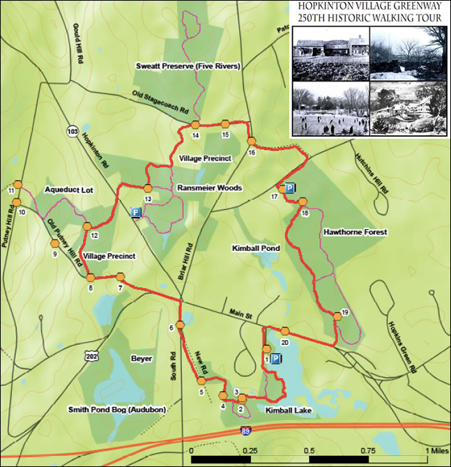
Author Archive

Mast Yard Forest

  • Overview

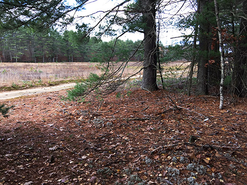
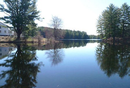
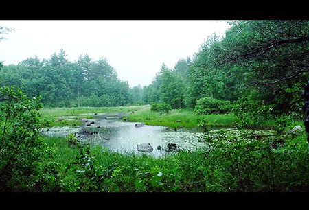
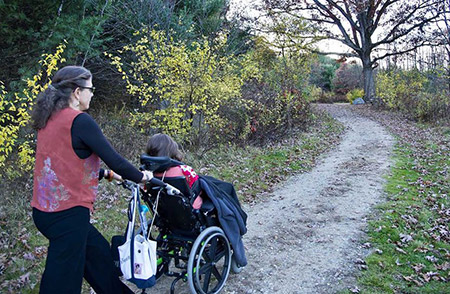
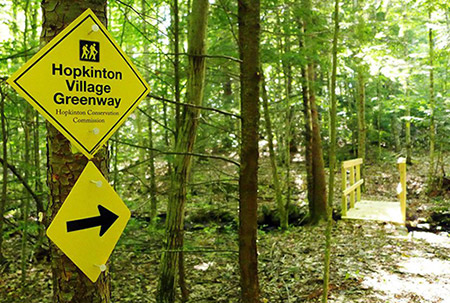
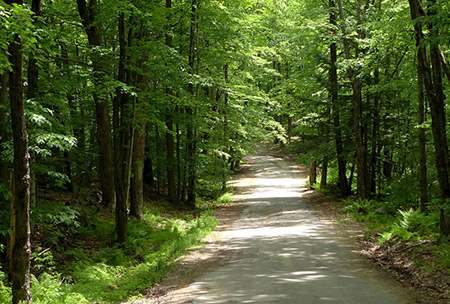
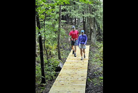
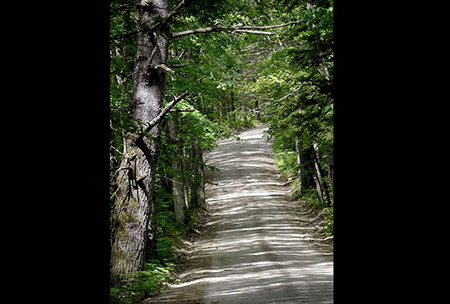
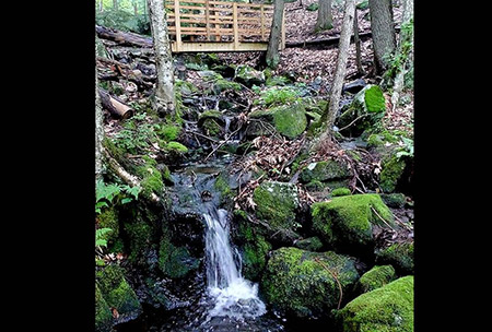
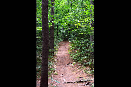
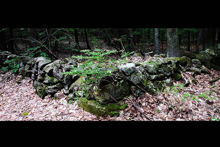
    Mast Yard State Forest lies in the northwest corner of Concord and northeast corner of Hopkinton, and provides 5 miles of interconnected trails that wind through shady forest and provide scenic views of Dolf Brook and the Contoocook River. The trails are open to hiking, mountain biking and cross-country skiing. Some trail sections follow former railroad grade, making them fairly flat, while others traverse slightly hillier terrain.

    Distance: About 5 miles total; hiking travel time: about two hours

    Directions: Take Broad Cove Road from Briar Hill Road. After passing under the powerlines, there is an opening on the left and a small area to park your car. Step over the large log to begin your walk.

  • The Trails

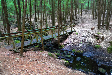
    The Mast Yard trail is a loop starting at the northwest corner of the parking lot off Broad Cove Road in Concord, just over the Hopkinton line. Taking the left fork after crossing Dolf Brook, turn right onto the old railroad bed, right again at the power lines and return over Dolf Brook. This loop, a total of about five miles, is relatively flat and excellent for hiking, mountain biking, and cross-country skiing with children. The trail along the railroad bed is linked via a pedestrian/snowmobile bridge over the Contoocook River to the Lehtinen Park Trails and Jim Hill River Walk in Concord.

    History

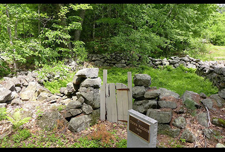
    According to Bouton’s History of Concord, in the early 1800’s this area was famous for supplying trees, two to three feet in diameter, that were used as masts for “His Majesty’s Royal Ships” and later as masts for various other vessels built on the seacoast. The best masts were from the northwesterly side of Horse Hill. The trees were “drawn” to the Contoocook River to an area now called the “Mast Yard,” then floated down to the Merrimack River. Larger logs were drawn by 52 teams of oxen (104 animals) along Borough Road to the sandbanks below Sewalls Falls and there “thrown” into the Merrimack River and floated to the coast.

    p>
  • The Mast Yard Forest trail map is shown below. Please click the text or image link to open/download/print the PDF map located on the City of Concord website.

    Mast Yard Forest Trails – Click here to open/download/print PDF map (City of Concord website).

Continue Reading

Kimball Lake

  • Overview

    This lovely lake, approximately 28 acres in size, has adjoining cabins and hiking trails and is located at 185 Main Street in Hopkinton. Residents are encouraged to use this area for snowshoeing, cross-country skiing, hiking, mountain biking, fishing and canoeing/kayaking.

    A nature walk is also available. The trail begins at the end of the gravel road, which is adjacent to the main cabin. This woodland trail follows the shore of Kimball Lake and offers two options for walkers. The shorter route loops back to the lake while the longer route connects to South Road via New Road, an unmaintained town road. From there it’s an easy walk down Hopkinton’s Main Street back to Kimball Lake. Alternatively, turn left on Main Street and walk to Old Putney Hill Road to join the Hopkinton Village Greenway, a 4.5 mile loop that connects the Kimball Lake trails to the trails at Ransmeier Woods and Hawthorne Forest.

    Directions:
    Located at 185 Main Street in Hopkinton Village; accessed via the gravel road next to Kimball Lake. Parking is available at the main log cabin.

    Walking times:
    Short yellow loop: 10 minutes; yellow trail from cabins to New Road: 20 minutes

  • From the parking area at the cabin, follow the gravel road to a footpath along the lake. The original trail, marked with yellow blazes, follows along the lakeshore to the height of land and then loops back through the woods to the shore.

    The main trail, part of the Hopkinton Village Greenway, continues west to New Road, a Class 6 road that connects to South Road. This section of the trail was built by the Hopkinton Conservation Commission after additional land was deeded to the town by the developers of the adjacent Fieldstone Road neighborhood.

    There is a short loop off the main trail, marked with red blazes, that leads to some large boulders.

    History

    The Kimball Lake property was given to the town in 1982 by the Swiftwater Girl Scout Council who received the property through a bequest from the Kimball Estate. The lake and cabins were developed by two public-spirited natives, John C. Kimball of Manchester and Harold C. Kimball of New York City.

    In 1931, the Kimballs hired unemployed workers in Hopkinton to rebuild the former mill dam on Mill Creek, dredge the swamp and create a lake. They constructed log cabins and operated the property as a lakeside resort, Horseshoe Trail Camp, for many years. The Kimball’s purchased the old blacksmith shop on the corner of Main Street and turned it into a restaurant called Horseshoe Tavern.

    Residents are encouraged to use this area for snowshoeing, cross-country skiing, hiking, mountain biking, fishing and canoeing and kayaking.

  • TThe Kimball Lake trail map is shown below. Please click the text or image link to open/download/print the PDF map.

    Kimball Lake Trails – Click here to open/download/print PDF map.

    kimball-lake-map

  • 1
    2
    3
    4

Continue Reading

Houston Fields

  • Overview

    Houston Fields, located off of Pine St. behind Hopkinton’s Town Library and Senior Center, is the gemstone of the town’s recreation facilities. It is designed to serve all age groups from the very young to the elderly and it is the home for most town-sponsored team recreation activities.

    At present it is comprised of two full-sized soccer fields, two multi-purpose fields used for lacrosse, soccer and football, an official little league field and a children’s playground. Picnic areas, one with views of the entire park, have been developed near the playground.

    Wheelchair accessible paths and nature viewing locations are also available. The trails on Houston Park connect with the town-owned Stevens Rail Trail to the north.

  • 1
    2

Continue Reading

Hopkinton Village Greenway

  • Overview

    The Hopkinton Village Greenway – 4.5 miles of walking trails – connects town forests and conservation lands surrounding Hopkinton Village. The Greenway links existing trails on Hawthorne Forest, Ransmeier Woods and Kimball Lake with new trails on other town parcels, private lands and Class 6 roads. The trail offers a unique opportunity for walkers of all ages to experience the natural lands that lie within a short distance of the Village center.

    Directions:
    The Greenway can be accessed at the trailhead parking areas at Kimball Lake, Ransmeier Woods, and Hawthorne Forest, or from the center of Hopkinton Village.

    Walking times:
    Approximately 2 ½ hours to complete the entire Greenway. Shorter loops are available by walking individual sections and following town roads or other trails back to starting point.

  • Description

    The Conservation Commission’s vision for a greenbelt of protected land around Hopkinton Village began in the early 1990’s following the acquisition of Hawthorne Forest. The Commission developed trails at Hawthorne Forest and Kimball Lake (donated to the town in 1982) and linked them to New Road, a Class 6 road off South Road. Gradually the Conservation Commission, with help from Open Space Bond funds and other funding sources, acquired additional lands surrounding the village center. Today, nearly 400 acres are protected around the village.

    The Hopkinton Greenway trail was developed and is maintained by an all-volunteer crew, under the leadership of the Conservation Commission. The trail is made possible by the generosity of private landowners who have permitted the trail to cross through their lands.

    Trail Description

    The 4-5 mile trail is marked with yellow blazes, arrows and signs. Starting at Kimball Lake and walking in a clockwise direction, the trail breaks into five sections:

    Kimball Lake to Hopkinton center: 1.23 miles
    Beginning at the parking area at Kimball Lake, the trail follows an old woods road along the lake. The trail skirts the edge of the water, then winds by wetlands and streams before joining the unmaintained section of New Road. Turn right on New Road and continue to South Road. Follow South Road to the center of Hopkinton by the Cracker Barrel Store.

    Hopkinton center to Route 103: .84 mile
    At the Cracker Barrel store, cross Route 202, turn left (Veteran’s Park will be on your right), and follow along the road to Old Putney Hill Road. Follow Old Putney Road .3 miles to a woods road on the right. The trail winds its way through forested land owned by the Hopkinton Village Precinct and the town’s Aqueduct Lot. Cross Route 103 to pick up the trail on the opposite side of the road.

    Route 103 to Stagecoach Rd at Sweatt Preserve: .61 mile
    This section begins on the northeast side of Hopkinton Road on the Ransmeier Woods property. A short section crosses over boardwalks and bridges before joining the existing blue trail of Ransmeier Woods. Turn left at the trail junction and follow the blue trail to its intersection with the Greenway. Turn left on the Greenway, heading north across private land to the junction with Old Stagecoach Road. The trail emerges directly across from the trail on the Sweatt Preserve.

    Note: From the parking area at the Ransmeier Woods trailhead (next to the Police Station on Hopkinton Road), follow the orange trail to the blue trail, cross over the footbridge and continue on the blue trail to its junction with the Greenway.

    Stagecoach Road to Hawthorne Forest trailhead: .79 mile
    Turn right on Stagecoach Road and continue .2 mile to Briar Hill Road. Turn right on Briar Hill and look for the Greenway trail on the left. The trail follows an unmaintained town road up the hill to Rollins Road. The upper portion of the public way serves as a driveway for several homes off Rollins Road. Cross Rollins Road and pick up the trail on the other side. The trail parallels Rollins Road until it joins the trailhead parking area at Hawthorne Forest.

    Hawthorne Forest trailhead to Kimball Lake trailhead: 1.15 miles
    Follow the Hawthorne Forest trail from the parking area, through the woods and across the footbridge. After the bridge, turn right and follow the yellow blazes to the connector trail to Main Street. Turn right on this trail (marked “to Main Street”), and turn right again on Main Street. It is .3 mile back along Main Street to Kimball Lake.

    Connector from Greenway to Putney Hill Road and Dolly Road
    In the fall of 2014, a new trail section was built to connect the Greenway to the historic sites on Putney Hill Road and to Dolly Road via the First Parsonage Road trail. The trail connector begins on Putney Hill Road at the historic cellar hole identified as the “First Parsonage”. To the east, the trail crosses a field and follows stone walls on the Aqueduct Lot town forest where it connects with the Greenway. Along this section of the trail, recent logging opened a view to the northeast. To the west of the First Parsonage site, the trail follows the old roadway downhill to Dolly Road.

  • The Hopkinton Village Greenway trail map and the Greenway Connector to Putney Hill and Dolly Road map are shown below. Please click the text or image link to open/download/print the PDF map.

    Hopkinton Village Greenway – Click here to open/download/print PDF map.

    greenway-map

  • Explore the history along the Hopkinton Village Greenway! From Kimball Lake to the Town Pound to the site of an Indian raid. Twenty informational stations will help you relive Hopkinton’s history while experiencing our beautiful conservation land.

    Self-Guided Historic Walking Tour GuideClick here to open/download/print PDF Tour Guide Brochure.

    Station Signs for Self-Guided Historic Walking Tour – Twenty signs that provide specific details about each of the historic sites are displayed along the Greenway. If you would like to view/download them, click here.

    historic-tour

  • 1
    2
    3
    4
    5
    6
    8
    9
    10

Continue Reading

Hawthorne Town Forest

  • Overview

    This 111-acre forest is located close to the center of Hopkinton Village, yet the well used hiking trail has a wild and remote feeling as it passes through thick hemlock groves and a steep gorge. The Hawthorne Forest trails connect to the Hopkinton Village Greenway.

    Directions:
    From Hopkinton Village, proceed north on Briar Hill Road for 0.3 miles, then right on Rollins Road for 0.3 miles. The parking pullout is located on the right.

    Walking times:
    Full 1.7 mile loop: 40 minutes. Shortened loop via cut-off trail: 25 minutes.

  • This 111-acre town-owned lot is located just east of Hopkinton Village between Rollins Road and the east end of Main Street.

    Despite its location close to the town center, the thick hemlock groves and steep gorge along Rachael’s Brook give parts of the forest a wild and remote feel. By contrast, farther along the trail the slopes become gentler and land is more open with oak and maple trees and numerous stone walls. The walls mark the old fields and pastures of hard-working farmers who cleared and worked this land. A descendent of those farmers, Rachael Hawthorne Johnson, deeded 93 acres of this land to the town in 1989 with the help of LCIP State conservation funding. The other 18 acres along Rollins Road have belonged to the town since 1933 and were used as a stump dump and by the Highway Department. The former stump dump is now a sledding hill.

    The 1.7 mile trail begins by a kiosk in the parking area off Rollins Road and is marked by yellow blazes. About 100 yards after entering the forest, the trail crosses a bridge over Rachael’s Brook. Soon after the crossing, a trail junction marks the beginning of the loop trail. To the right are steep slopes and hemlock groves. To the left the trail rises more gradually.

    There is a cut-off situated halfway through the loop. The cut-off is about 200 yards long and reconnects to the loop trail.

    There is also a trail spur to Main Street which comes out just before Hawthorne Hill Road. It’s a short walk down Main Street to connect with the trails at Kimball Lake. These trails are part of the Greenway loop trail around Hopkinton Village. From the trailhead parking on Rollins Road, the Greenway trail heads east, parallel to Rollins Road, before crossing Rollins Road and following an unmaintained town road to Briar Hill Road.

  • The Hawthorne Town Forest trail map is shown below. Please click the text or image link to open/download/print the PDF map.

    Hawthorne Town Forest Trails – Click here to open/download/print PDF map.

    hawthorne-map

  • 1
    2
    3
    4
    5
    6

Continue Reading

Copyright 2026© Hopkinton NH Conservation Commission and Open Space Committee